Burke Report and Rationale Overview
After the severe flooding experienced in June 2010, the City of Elmhurst hired Burke Engineering to conduct a study, the main objective of which was to analyze 10 key flood problem areas in the City and to develop concept-level drainage improvements to alleviate the flooding in each area. Of the 10 flood areas identified, Burke recommended that Park District property could be utilized to partially alleviate flooding in five of those areas.
Burke utilized available data and calibrated computer modeling to simulate flood reduction benefits. Proposed drainage improvements analyzed in this study included: increased storm sewer sizes, constructing relief sewers, creating flood storage in open space, providing flood storage underground, and increasing pumping rates of existing stormwater pumping stations. No other possible improvements were considered.
Burke provided conceptual-cost estimates, but these estimates did not include land acquisition, temporary/permanent construction easements, relocation of utilities, or the cost of recreation facilities in open space.
Burke provided more than one alternative for most study areas with the goal of providing 50-year or 100-year flood protection. (The term "50-year flood" and "100-year flood" are used to define a rainfall event that has a 1% probability of occurring every 50 years, or once every 100 years respectively.)
Burke proposed a number of improvements for each alternative, Listed below are proposed improvements directly impacting Park District property.
Burke Recommendations for Pioneer Park and Wild Meadows Trace
Impacts Flood Study Area - Seminole Avenue
The Burke Seminole Avenue study area is located north of the Illinois Prairie Path and west of York Street. The flood problem area is the low-lying area located at the intersection of Seminole Avenue and Cottage Hill Avenue. The area drains by storm sewer and overland flow to this low spot, which outlets through a 48-inch diameter storm sewer that drains westward until its ultimate outlet into Salt Creek. Because there is no overland flow path for this area, street flooding, and eventually structural flooding, occurs along Seminole Avenue during storm events that exceed the capacity of the existing storm sewer.
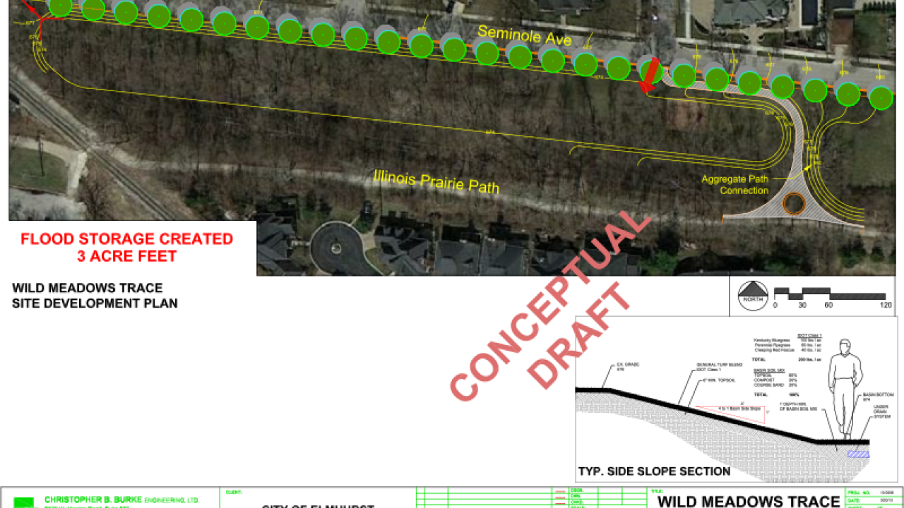
Because the existing level of flood protection in this study area is relatively high (25-year), the objective of the proposed drainage improvements was to provide flood protection during the larger-magnitude storm events. Due to the limited open space that is available in this study area, two drainage alternatives were determined to be the most feasible options for increasing the level of flood protection for this study area. These drainage alternatives both rely on the creation of flood storage on open parcels that are owned by the Elmhurst Park District.
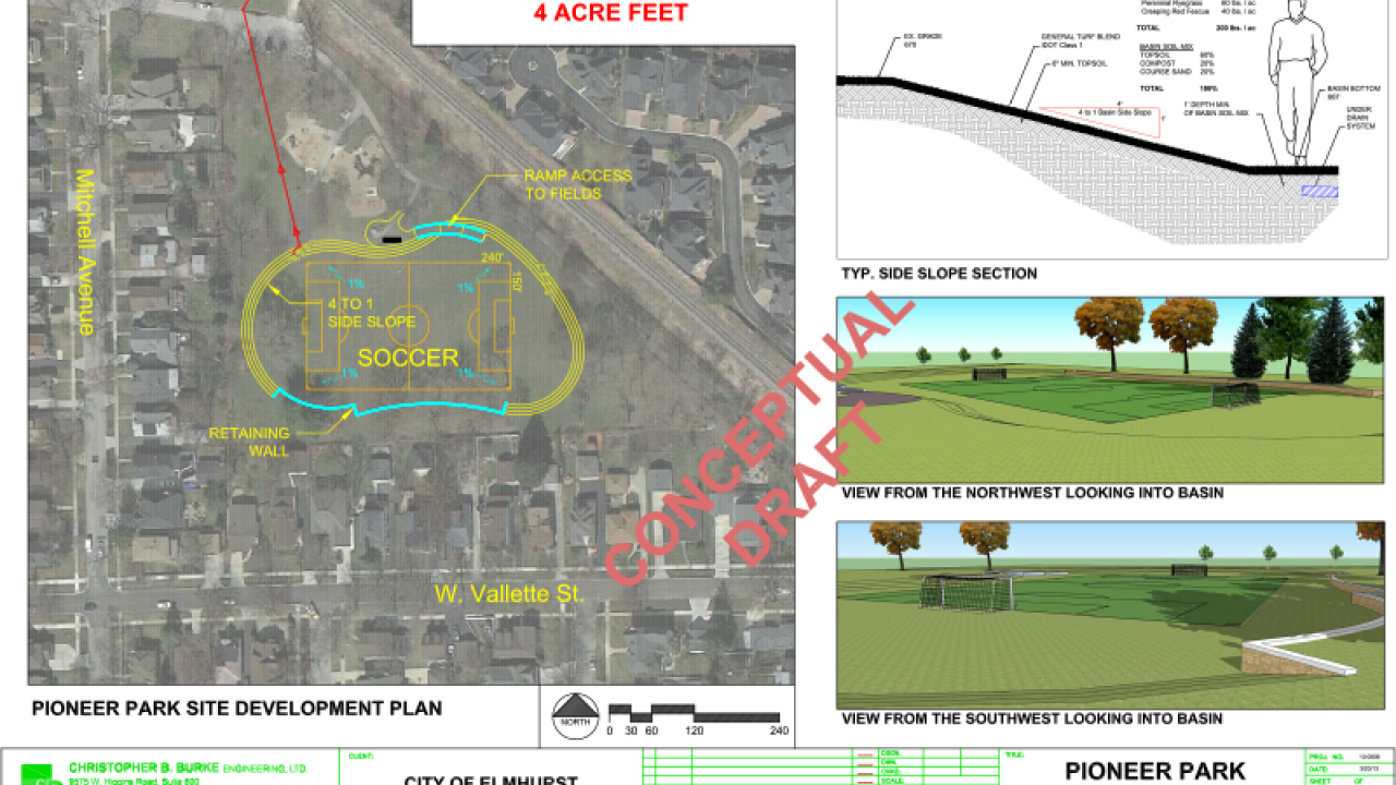
Alternative #1 100-year Flood Relief - Sewer/Flood Storage at Pioneer Park
-
Installation of 1,300 linear feet of relief sewer from the low spot at Seminole Avenue and Cottage Hill Avenue to Pioneer Park.
-
Provide an additional 4 acre-feet of gravity-drained flood storage by utilizing the open space in Pioneer Park.
Alternative #2 100-year Flood Relief - Overland Flow Route/Flood Storage along Seminole Avenue
-
Provide an additional 3 acre-feet of gravity-drained flood storage by utilizing the Elmhurst Park District property between Seminole Avenue and the Illinois Prairie Path.
-
Create an emergency overflow route along the south side of Seminole Avenue to convey street flooding to the flood storage area.
Number of Homes Protected from a 100-year Event by utilizing Pioneer Park and Wild Meadows Trace as Detention Basin
Alternative #1 = 4 Homes
Alternative #2 = 4 Homes